NCTCOG Discovery


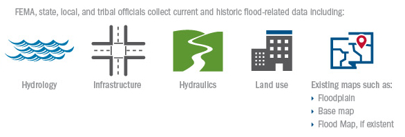
The North Central Texas Council of Governments (NCTCOG) has partnered with the Federal Emergency Management Agency (FEMA) to perform Discovery throughout the Upper West Fork Trinity HUC-8 Watershed. Discovery is a step in the Risk MAP process in which communities are able to share flood risk concerns, identify areas at risk for flooding, and discuss solutions to reduce risk. You can help by ensuring the data about your community is current and accurate.
The overall goal of Discovery is for FEMA to partner with local communities and identify stakeholders to review and validate gathered flood risk data as well as discuss the vision for the watershed's future.
By logging in with your email address and the password provided during the Pre-Discovery Meeting, you can help NCTCOG refine the gathered regional flood risk data with local information regarding mapping needs and local flood risk data. Information such as flood-study needs, historical flooding locations, development plans, mitigation plans, floodplain management plans, etc. is needed. The contact information enables more local as well as watershed-wide follow-up conversations about flood-risk decision making activities.
Click here to download a list of commonly used Discovery related acronyms.
Partners in the Discovery process include:
A detailed description of the Discovery process is located here.

At this time, NCTCOG is asking communities to help:
A list of Flood Risk related definitions and acronyms are available here.
No password?
Please email us and we'll help get things sorted out.